


Fort Freinet-la Garde-Freinet-02-06-23

Christiancordin
User
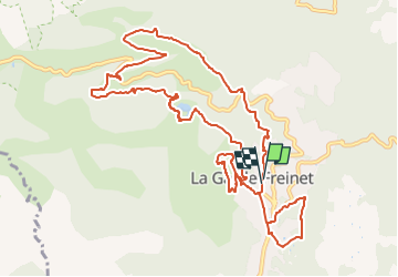

Length
14 km

Max alt
431 m

Uphill gradient
501 m
Km-Effort
21 km

Min alt
141 m

Downhill gradient
494 m
Boucle
Yes
Creation date :
2023-06-02 16:36:16.758
Updated on :
2023-06-02 16:44:13.564
4h41
Difficulty : Medium

FREE GPS app for hiking
 SityTrail
IGN / Geographical institutes
SityTrail Plus
The world is yours!
About
Trail On foot of 14 km to be discovered at Provence-Alpes-Côte d'Azur, Var, La Garde-Freinet. This trail is proposed by Christiancordin.
Description
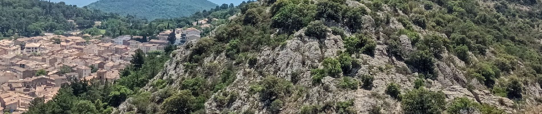
Pk-oratoire-Serre Long--ruisseau des neuf Riaux-moulin de Blanche-rucher de Blay-fort Freinet-croix des Maures-la Garde Freinet-chapelle.
Photos


Positioning
Country:
France
Region :
Provence-Alpes-Côte d'Azur
Department/Province :
Var
Municipality :
La Garde-Freinet
Location:
Unknown
Start:(Dec)
Start:(UTM)
294890 ; 4799409 (32T) N.
Comments